This project is from 2021 Florida Hacks with IBM.
Team: Taeho Lee, Chloe Ko, Tiffany Dinh
Tool: Python
Project Description and Objectives
Improving the Condition of Florida’s Waterways
Florida’s springs, rivers, and estuaries define the natural aesthetic of the state and are largely responsible for establishing Florida as the 16th largest economy in the world. However, the physical, chemical and biological condition of the state’s waterways are dramatically changing due to climate change, shifts in land use, and population growth. Harmful algae blooms, macro algae blooms, pathogen outbreaks and hypoxia (low oxygen events) are now pervasive in many waterways, threats that are projected to worsen with warming temperature and continued land use change.
This challenge invites participants to find applications to help increase the productivity and optimization of land use and improve zoning laws to promote better land use.
Methodology
To find out the impact of land use on Florida’s waterways, We proceeded to collect and analyze the data through the following steps.
- Define what is polluted water
- Gather data for 1
- Gather data for land use
- Use all the data and find cause of pollution
- Offer solutions
There are several measures to determine the level of water pollution, but we decided to focus on the area where algae bloom occurred. This is because algae blooms are very toxic so that adversely affect the community by causing disease to the residents or the death of fish. Therefore, we set the area where the algae occurred as the area where the water was contaminated and collected data.
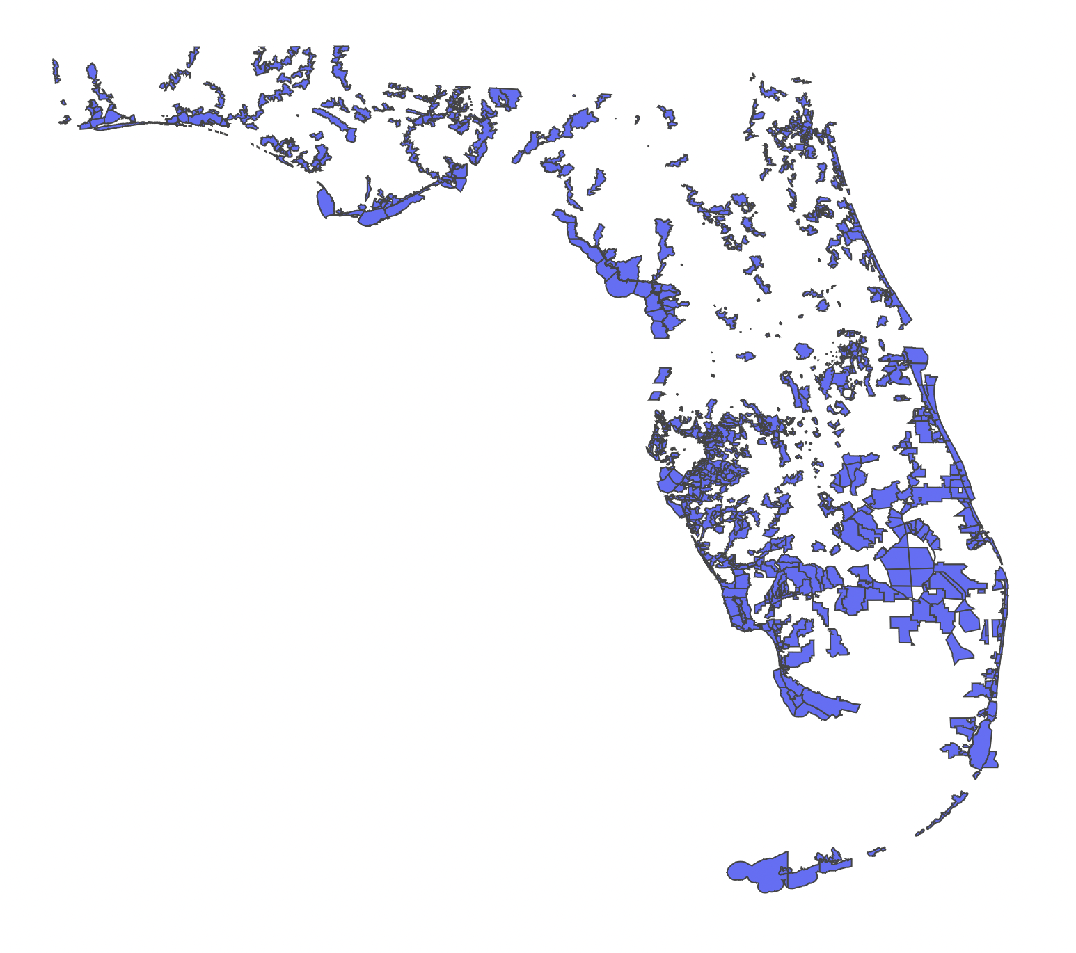
First, these are the verified waterbodies in Florida. We used geojson file to plot this.
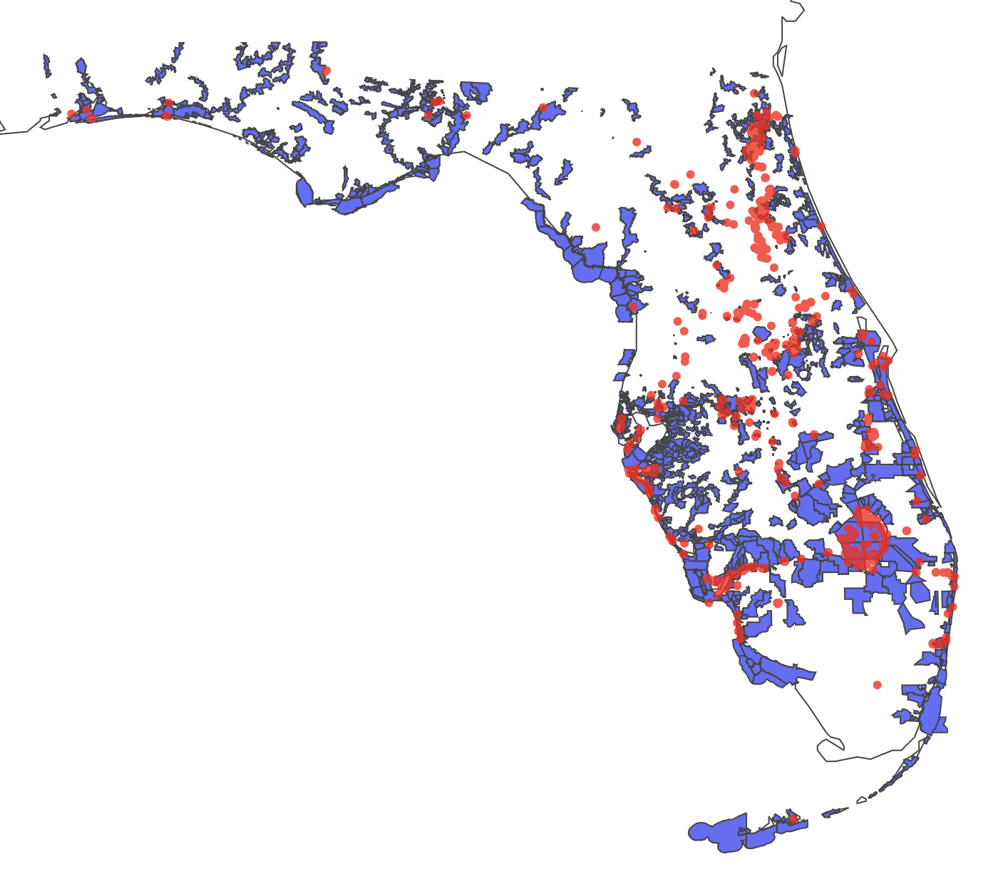
Next, the regions where algae bloom occurred are as follows.
We downloaded the “land use” data in Florida, and plot it with algae bloom areas. As a result of matching the algae bloom area with the area according to the land use classification, the following three land use areas closely overlapped.
Land Use Code : 1200 (Residential Medium Density)
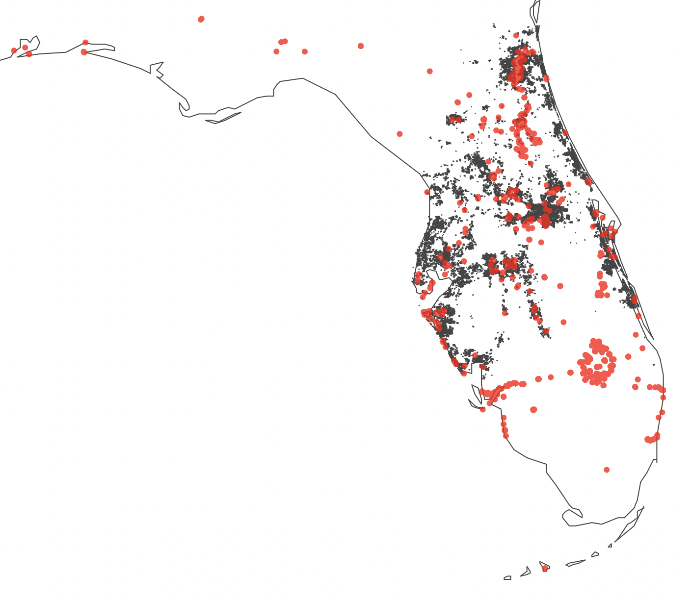
Land Use Code : 1400 (Commercial and Services)

Land Use Code : 1700 (Institutional)
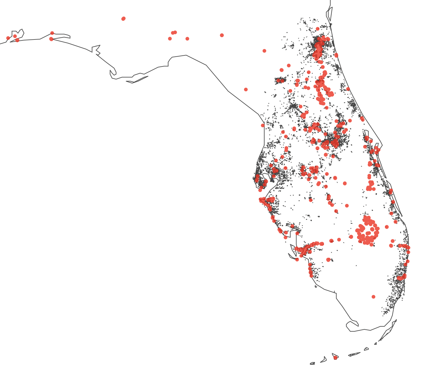
It may be a very natural result, but we can see that the densely populated residential area, the commercial area, and the institutional area overlapped the algae bloom area. We can infer that the reason for this is that the more populated the area, the more substances that pollute the water.
One interesting thing was that I thought there might be a close relationship between agricultural land use area and water pollution, but there is not much of a relationship.
Challenges
-
The geojson file of land use data was too large, so there was a problem that it took too long to read. Therefore, we created separate geojson file and used it by land use code.
-
Because of the focus on land use, we did not think of collecting data on the more fundamental causes of water pollution. If we had more time, we would collect data on what pollutants are emitted from densely populated areas and commercial areas.
Conclusion
In terms of land use, we can find that densely populated areas and commercial areas were related to water pollution. Therefore, there is a need to strengthen the zoning law to prevent the expansion of populated areas and commercial areas. Additionaly, strengthening regulations on the discharge of pollutants in these areas are needed.


